Home Page
Kingdom
Index Plant
Index Magnoliopsida
Index Dryopteridaceae
Index
11 photos.
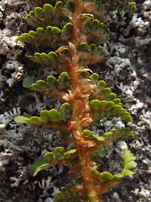
This is the "rusty cliff fern" also known as the "rusty Woodsia"
or "oblong Woodsia".
It hybridizes with Woodsia alpina. The genus Woodsia is now
placed in the family
Woodsiaceae, the cliff ferns.
ITIS Taxonomic Serial No. 17741
1. May 22, 2011. Several clusters of plants surrounding a rock.
2. May 22, 2011. A cluster of plants with stems from a previous year visible in the foreground. Leaves are just turning green. |
3. May 22, 2011. Closer view of another cluster. |
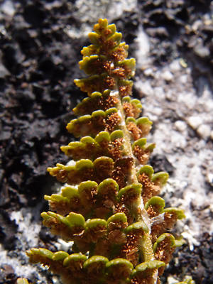
4. May 22, 2011. Stem with the undersurface" of the frond visible, showing the hairlike indusia which protect the spores |
|
5. May 22, 2011. Similar to photo 4 but the indusia are more highly developed. Note the scales on the rachis. |
6. May 22, 2011. A leaf with both the upper and lower surfaces of the pinnae visible. |
|
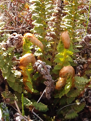 8. June 9, 2012. four fronds just uncurling. |
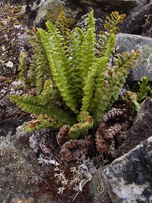 9. June 9, 2012. A cluster of fronds with dead fronds from the previous year. |
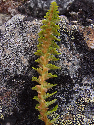 10. June 9, 2012. Upper section of a frond prior to sporulation. Scales on rachis prominent. |
 11. August 10, 2012. Section of a frond. Indusia absent showing the underlying structures. Also visible, the scales and hairs on the rachis. |
Photos 1-7 taken on the SW side of the Photos 8-10 taken 1.5 miles Photo 11taken along upper Half |
|