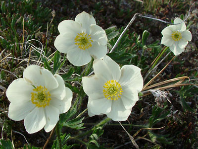
 |
 |
 |
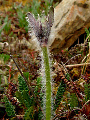
2. Early June. Sprouting stem with involucral
bracts.
|
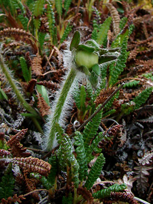
3. Early June. Sprouting stem with bud.
Basal leaves have not appeared.
involucral bracts partially enclose the bud
|
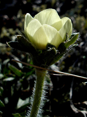
4. Late May. Upper stem, involucral bracts
and partially opened blossom.
|
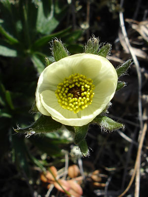
5. Late May. Top view of blossom in
photo 4.
|
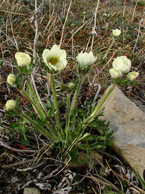
6. Early June. Multi-stemmed plant in early
stage of bloom. Some of the stems have
multiple blossoms. The pedicels will elongate
with age.
|
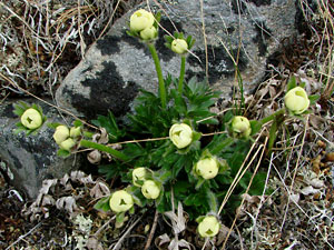
7. Early June. Another Plant similar to the one
in photo 6.
|
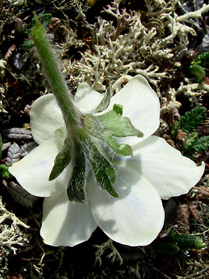
8. Early June. View of underside of blossom.
involucral bracts are still close to sepals.
|
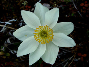
9. Mid-June. A single blossom.
|
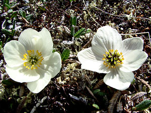
10. Mid-June. Two blossoms with the seeds
beginning to develop. The blossom on the
right is at a later stage.
|
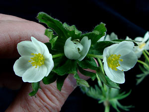
11. Mid-June. Top view of a stem with
multiple blossoms.
|
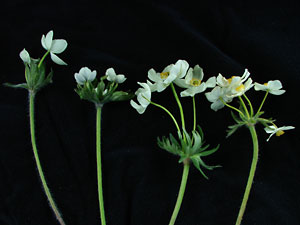
12. Mid-June. Several stems with multiple
blossoms. Note how the pedicels have elongated.
|

13. Mid June. Two blossoms from adjacent
plants. This shows the variation in sepal shape.
|
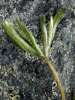
14. Late June. A basal leaf.
|
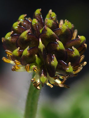
15. Mid-June. A fruiting head.
|
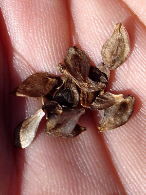
16. Early September. Seeds.
|
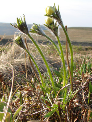
17. June 3, 2009. A mult-istemmed
plant in bud.
|
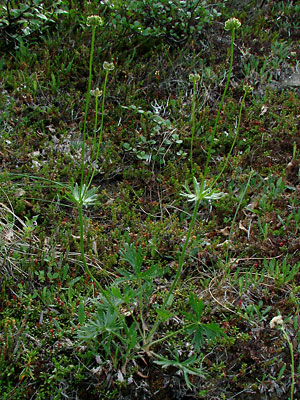
18. July 11, 2009. A two-stemmed plant
in seed. Note how the pedicels have
elongated.
|
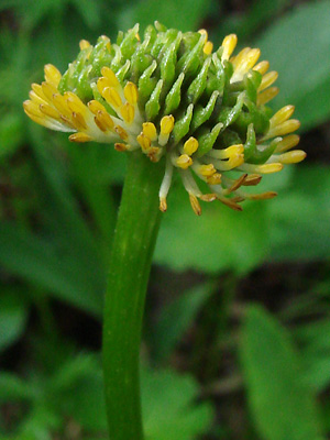
19. July 11, 2009. A fruiting head at an
early stage with the stamens still attached.
|
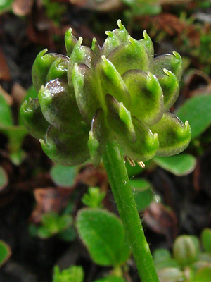
20. July 11, 2009. A fruiting head at a
later stage. Most of the stamens have dropped
off.
|
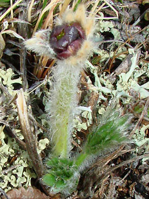
21. May 22, 2011. A sprouting plant
with a bud in a very early stage.
|
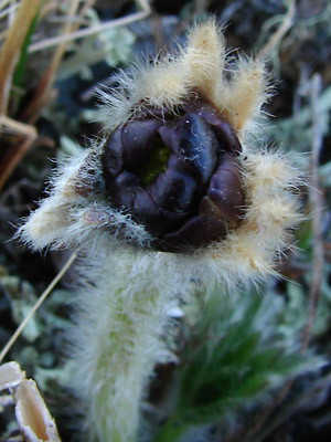
22. May 22, 2011. Close-up of the
early bud in photo 21
|
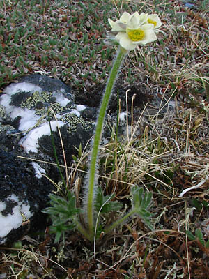
23. May 28, 2011. The plant in photos
21 and 22 taken 6 days later. Note
that the plant is now much less hairy. |
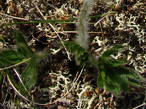
24. May 28, 2011. Basal leaves on a
rcently sprouted plant. |
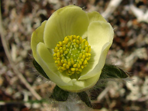
25. May 28, 2011. A single, barely opened,
yellow blossom
|
Photos 1 and 16 taken along the Pinnell
Mountain Trail beyond milepost 2.
65° 29.72' N, 145° 28.02' W
Elev. 3850 ft.
Photos 2, 3, 6-9 and 11-14
taken on the Central
side of Eagle Summit.
65° 30.08' N, 145° 22.84' W
Elev. 3700 ft.
Photos 4 and 5 taken on a ridge 2 miles
southeast of Portage Summit.
65° 24.78' N, 144° 40.73' W
Elev. 2900 ft.
Photo 10 taken 1.5 miles northeast
of Portage Summit.
65° 26.46' N, 144° 47.50' W
Elev. 2650 ft.
Photo 15 taken along small road
on Eagle Summit.
65° 29.71' N, 145 °23.12' W
Elev. 3850 ft.
|
Photo 17 taken on Eagle Summit
at the Pinnell trailhead road.
65° 29.03' N, 145° 24.52' W
Elev. 3600 ft.
Photos 18-20 taken in a ravine west of
Twelvemile Summit.
65° 23.6' N, 145° 58.8' W
Elev. 2950 ft.
Photos 20-23 taken on the east side of
the saddle between Miller Fork of
Eagle Creek and Miller Creek.
Latitude: N 65° 28' 37.481"
Longitude: W 145° 22' 28.838"
Altitude: 1134.97 m.
Photos 24 and 25 taken above the west side
of the saddle between Miller Fork of
Eagle Creek and Miller Creek.
Latitude: N 65° 28' 25"
Longitude: W 145° 21' 40"
Altitude: 1200 m.
|
|
| |
|
|
| |
|
|
| |
|
|
| |
|
|


