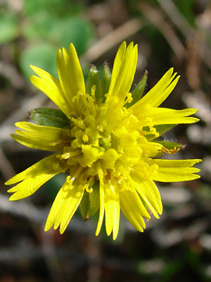
1. June 12, 2009. A blossom with 13 long
ligules. The disc flowers are almost in full
bloom.
|
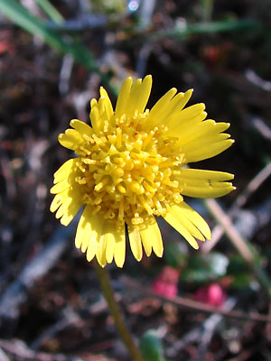
2. June 12, 2009. A blossom with 13 long
ligules. The disc flowers are in full bloom.
|
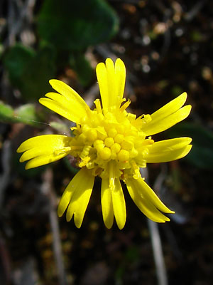
3. June 12, 2009. A blossom with 8 long
ligules. Some of the disc flowers are in bud
and some are in bloom.
|
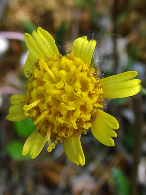
4. June 12, 2009. A blossom with 8 long
ligules. The disc flowers are in full bloom.
|
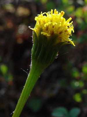
5. June 12, 2009. A blossom with short
ligules. The disc flowers are in full bloom. Note
that the hairs seen by transmitted light at the
upper left are purple
|
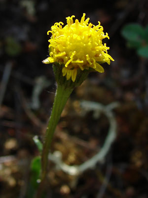
6. June 12, 2009. Another view of the
blossom in photo 5.
|
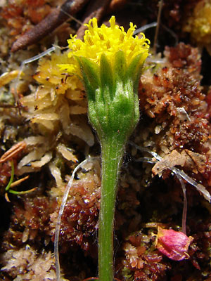
7. June 12, 2009. A profile view of a blossom
with very short ligules which barely extend
beyond the phyllaries. Note the hairs on
the phyllaries.
|
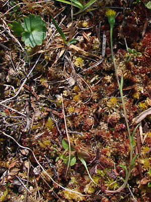
8. June 12, 2009. The entire plant.
|
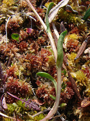
9. June 12, 2009. The lower stem leaves
of the plant in photo 7 and 8.
|
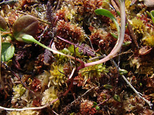
10. June 12, 2009. Lower section of the
plant with the basal leaves and a portion
of the creeping rhizome.
|
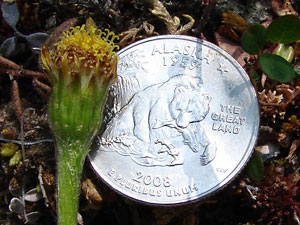
11 June 12, 2009. A drying short-liguled
blossom.
|
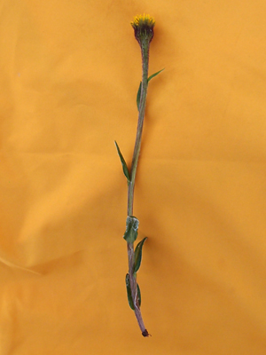
12. June 9, 2012. A plant without visible.
ligules
|
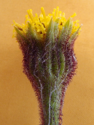
13. June 9, 2012. Close-up of the
blossom of the plant in photo12. The
purple hairs are quite evident.
|
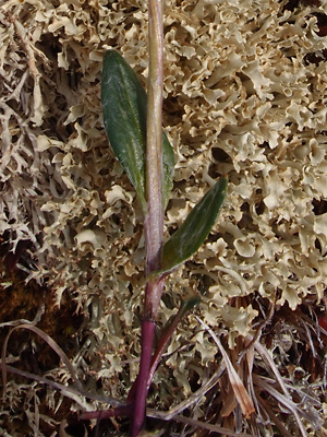
14. June 11, 2012. Lower stem including
a portion which was underground.
|
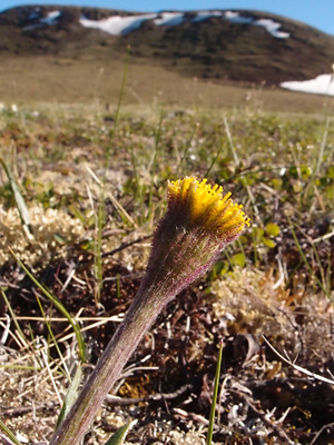
15. June 18, 2013. A single hairy blossom.
|
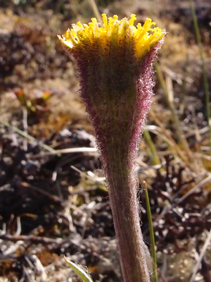
16. June 18, 2013. A single very
hairy (tomentous) blossom
|
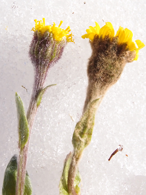
17. June 18, 2013. Tephroseris kjellmanii
on the right. On the left, Tephroseris frigida
perhaps hybridized with kjellmanii.
|
Photos 1, 3 and 4 taken on the
Hillside above the right limit of Harrison creek
between Squaw creek and Bottom Dollar creek.
Latitude: N 65° 22' 26.817"
Longitude: W 144° 51' 1.732"
Altitude: 674.39 m
Photos 2, and 5-11 taken on the
Hillside above the right limit of Harrison creek
between Squaw creek and Bottom Dollar creek.
Latitude: N 65° 22' 27.93"
Longitude: W 144° 51' 1.4917"
Altitude: 659.74 m
Photos 12 and 13 taken 2 miles
southwest of Portage Summit
Latitude: N 65° 24' 23.8"
Longitude: W 144° 45' 41.0"
Altitude: 941.75 m.
Photo 14 taken west of the mountain
listed by USGS as Eagle Summit.
Latitude: N 65° 28' 54.4"
Longitude: W 145° 24' 16.4"
Altitude: 1099.89 m.
|
Photos 15-17 taken on the Central
side of Eagle Summit.
65° 30.0' N, 145° 22.6' W
Elev. 3700 ft. |
|
|


