Home Page
Kingdom
Index Plant
Index Magnoliopsida
Index Caryophyllaceae
Index
Minuartia macrocarpa (Pursh) Ostenf.
12 photos.
The "longpod stichwort" a variable high arctic species favoring
rocky terrain previously misidentified as
Minuartia arctica (Stev. ex Ser.) Graebn.
ITIS Taxonomic Serial No. 19981
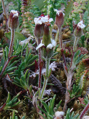
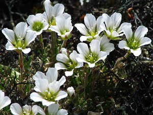
1. Mid-June Several blossoms and buds.
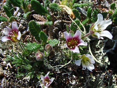
 2. Mid-June Top view of plant(s?) showing variation of color at the base of the petals. |
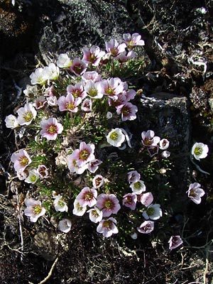
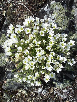
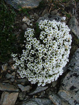 3. Late June. Plant with large number of blossoms. This is typical of the species. |
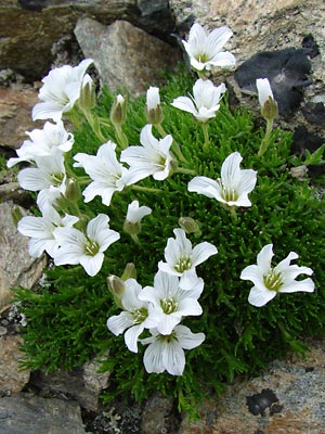
 4. Late June. Less clustered blossoms with green petal bases. |
 5. Early June. Another open cluster with a good view of stamens, styles and sepals. |
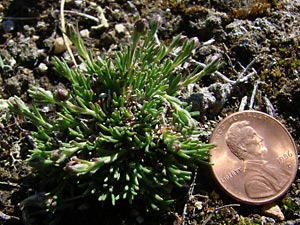 6. Mid-June Plant in bud stage. |
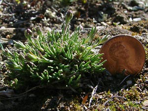 7. Another view of 6. |
 8. June 8, 2009. Close-up of several blossoms with green petal bases. |
|
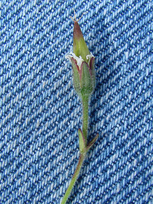 10. July 29, 2009. Close-up of upper stem with capsule, withered petals, calyx leaves with purple margins and short stem leaves. |
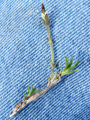 11. July 29, 2009. Branched stem showing difference in size and shape of the upper s tem leaves and lower leaves. |
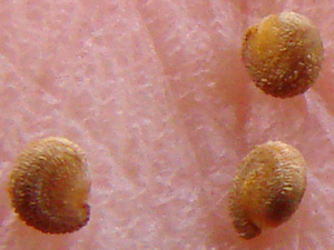 12. Seeds from the capsule in photo 11. |
Photo 1 taken on a ridge above the Photo 2 taken on a ridge above Baker Photo 3 taken at approximately 4.5 mile Photo 4 taken on a ridge 2 miles |
Photo 5 taken on the east side of Eagle Photos 6 and 7 taken 2 miles Photo 8 taken on a ridge 1.3 miles north Photos 9-12 taken above the Pinnell |
||