Home Page
Kingdom
Index Plant
Index Magnoliopsida
Index Brassicaceae
Index
Cardamine purpurea Cham. & Schlecht.
16 photos.
"Bittercress", "purple bittercress" or "purplecress",
a North American alpine species found in Alaska
and the Yukon Territory.
ITIS Taxonomic Serial No. 22809
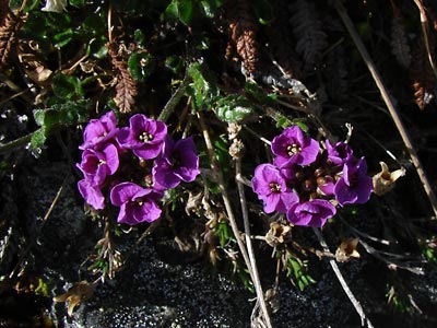
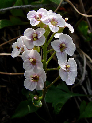
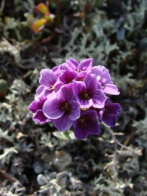
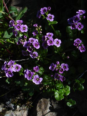
1. Late June. Top view of deep magenta blossoms.
 2. Mid-June. Top view of lighter blue-magenta blossoms. |
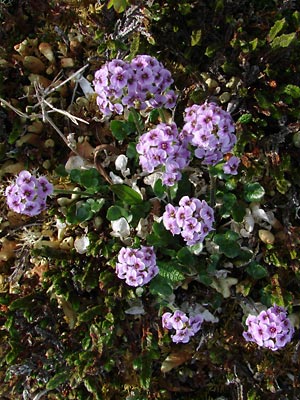 3. Late June. Top view of a larger group of plants with light blue-magenta blossoms. |
 4. Late June. Top view of a larger group of plants with magenta blossoms. |
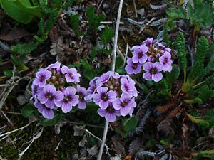
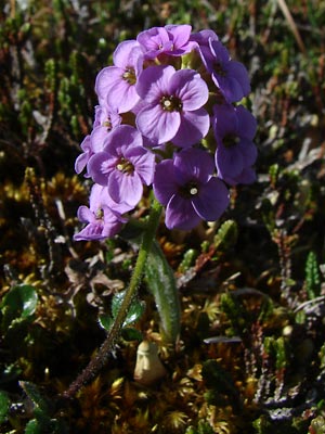
 5. Mid-June. Close-up of terminal cluster of blossoms with color intermediate between previous plants. |
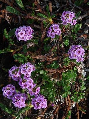
 6. Late June. Close-up of terminal cluster of blue-magenta blossoms. |
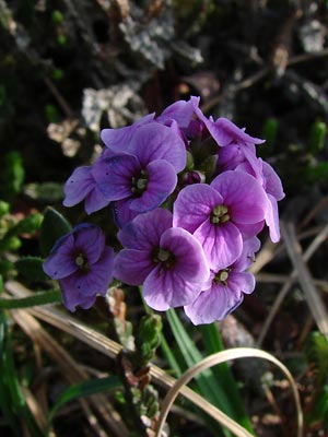 7. Mid June. Close-up of terminal cluster of magenta blossoms. Color is beginning to change. |
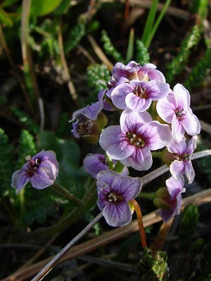 8. Mid June. Close-up of terminal cluster of light blue-magenta blossoms. Petals ar beginning to dry out and style on left blossom is protruding |
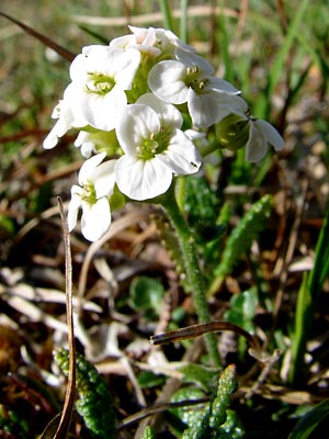 9. Late June. Close-up of terminal cluster of white blossoms. Hultén identifies this as var. albiflora however his classification has been rejected. |
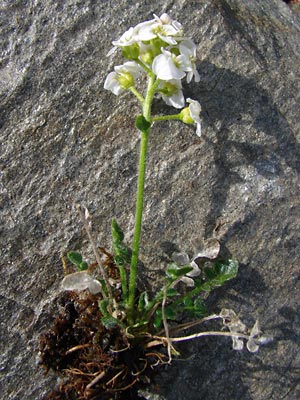 10. Entire plant in photo 9. |
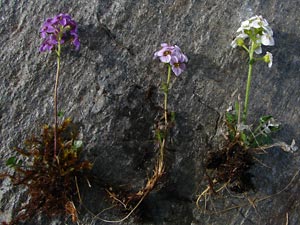 11. Entire plants of three different colors. |
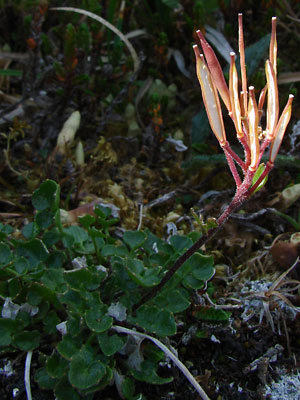
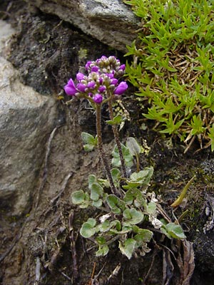 12. Early June. A plant in bud growing in dirt rather than tundra. Leaves and stem are quite hairy. |
 13. Early July. Plants with glabrate basal leaves growing in a streambed. |
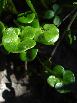 14. Close-up of glabrate basal leaves in 13. |
|
|
Photos 1, 3, 4, 6 and 12 taken along Photos 2, 7 and 8 taken on Central Photo 5 taken in saddle between Miller Fork
|
Photos 9, 10 and 11 taken 700 ft. Photos 13 and 14 taken beyond the end Photos 15 taken on the hillside above |
Photo16 taken on the hillside above
|