
Home Page
Kingdom
Index Fungi
Index Lichen
Index
3 photos.
A squamulose-fruticose species known as the "lesser sulphur-cup".
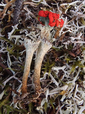 1. August 10, 2012. Profile view of two podetia removed from soil, one with red apothecia. |
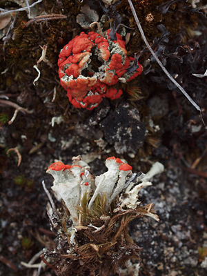 2. May 30, 2010. Top view of several podetia with apothecia with another specimen removed from soil. |
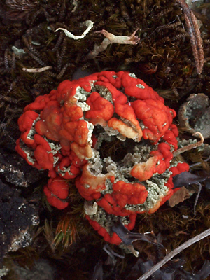 3. May 30, 2010. Close-up of the upper specimen in photo 2. |
| Photo 1taken on the hillside Photos 2 and 3 taken on the ridgetop
|
||